Planning a well in Hood County?

We answer the phone.
When you call, you’ll get a real person — often Matt Muller himself, not a machine. We stay in touch because it’s the right way to do business, and we show up when we say we will.
Water Well Drilling & Service in Hood County, Texas
Hood County sits over the Trinity (Paluxy / Glen Rose / Twin Mountains) aquifer system (outcrop / shallow confined). Most residential wells target the Paluxy Sand (upper Trinity); depth varies meaningfully across the county and is best estimated from neighboring TWDB well records. Drilling is regulated by the Upper Trinity GCD, which requires a pre-drilling permit.
Services We Provide in Hood County
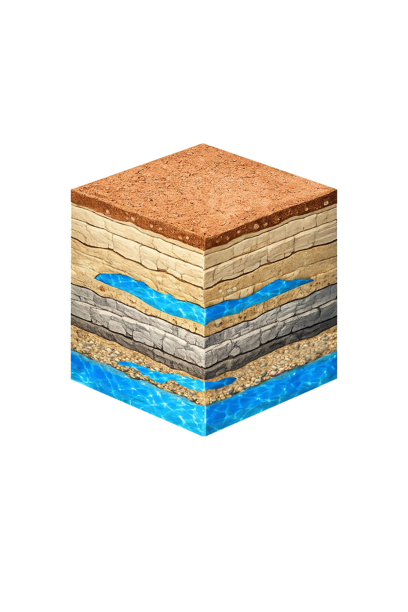
What’s Under Hood County: a Layer-by-Layer Look
About this diagram
This cross-section shows the actual rock formations beneath Hood County, from topsoil down to the Trinity aquifer system.
Tap any layer in the image, or any layer in the list, to explore each layer and what it means for drilling a well on your property.
- Topsoil — Cross Timbers / Lampasas Cut Plain0–15 ft
- Comanche Peak / Walnut limestone15–80 ft
- Paluxy Formation80–250 ft
- Glen Rose Formation250–400 ft
- Twin Mountains Formation400–550 ft
Hood County stratigraphy — top to bottom
- Topsoil — Cross Timbers / Lampasas Cut Plain
- Thin rocky reddish-brown soil with cedar and limestone debris.
- Comanche Peak / Walnut limestone
- Thin tan limestone and marl cap above the Paluxy; low permeability and non-water-bearing — part of the confining cover the well passes through before reaching Trinity sand.
- Paluxy Formation
- Upper Trinity sand — fine to medium cross-bedded sand with silt and clay; small-to-moderate yields. A primary residential target across Hood County where it is reached above the Glen Rose (Trinity Paluxy / Glen Rose / Twin Mountains; UTGCD 2023 Management Plan).
- Glen Rose Formation
- Mostly limestone with shale and anhydrite, forming distinctive stepped ledges. It mainly acts as a confining layer — sealing water off — between the Paluxy and the Twin Mountains, though cracked zones give up a little.
- Twin Mountains Formation
- The most productive Trinity layer once a well reaches it. Wells usually finish in its lower part and draw moderate to large amounts of fresh to slightly salty water. The rock is mostly medium-to-coarse sand and conglomerate, with massive sand low down.
0–15 ft
15–80 ft
80–250 ft
250–400 ft
400–550 ft
Hood County stratigraphy — top to bottom
- Topsoil — Cross Timbers / Lampasas Cut Plain (0–15 ft)
- Thin rocky reddish-brown soil with cedar and limestone debris.
- Comanche Peak / Walnut limestone (15–80 ft)
- Thin tan limestone and marl cap above the Paluxy; low permeability and non-water-bearing — part of the confining cover the well passes through before reaching Trinity sand.
- Paluxy Formation (80–250 ft)
- Upper Trinity sand — fine to medium cross-bedded sand with silt and clay; small-to-moderate yields. A primary residential target across Hood County where it is reached above the Glen Rose (Trinity Paluxy / Glen Rose / Twin Mountains; UTGCD 2023 Management Plan).
- Glen Rose Formation (250–400 ft)
- Mostly limestone with shale and anhydrite, forming distinctive stepped ledges. It mainly acts as a confining layer — sealing water off — between the Paluxy and the Twin Mountains, though cracked zones give up a little.
- Twin Mountains Formation (400–550 ft)
- The most productive Trinity layer once a well reaches it. Wells usually finish in its lower part and draw moderate to large amounts of fresh to slightly salty water. The rock is mostly medium-to-coarse sand and conglomerate, with massive sand low down.
Drilling in Hood County means starting in topsoil, working through Brazos / Lake Granbury alluvium (localized), Paluxy Sand (upper Trinity), Glen Rose Formation, to reach the Twin Mountains Formation — the producing zone for most domestic wells.
The full layer-by-layer stratigraphy is laid out under the cube above. Well depth in Hood County varies by property location and overburden thickness; we review TWDB records for neighboring wells to refine the expected completion zone before drilling.
Hood County Quick Facts
- Primary Aquifer
- Trinity (Paluxy / Glen Rose / Twin Mountains)
- Typical Well Depth
- Varies by location
- Groundwater District
- Upper Trinity GCD
- Confinement
- outcrop / shallow confined
We estimate from nearby well records
Cities We Serve in Hood County
Cresson, TX
Licensed well drilling and pump service in Cresson — a tri-county area straddling Hood, Parker, and Johnson. Confirm your parcel's county before drilling.
View Cresson details →Granbury, TX
Licensed well drilling and pump service in Granbury and Hood County. Hard limestone Trinity geology — specialized equipment required.
View Granbury details →Lipan, TX
Licensed well drilling and pump service in Lipan and western Hood County. Hard limestone Trinity geology — specialized equipment required.
View Lipan details →Tolar, TX
Licensed well drilling and pump service in Tolar and western Hood County. Hard limestone Trinity geology — specialized equipment required.
View Tolar details →Permits & Regulations in Hood County
Hood County wells are regulated by the Upper Trinity GCD. A pre-drilling permit is required before any new well is constructed. DFW Well Service submits the permit application as part of our drilling process.
Full Hood County permit & regulations →Frequently Asked Questions about Hood County Wells
What aquifer is under Hood County?
How deep are wells typically drilled in Hood County?
Does Hood County require a permit to drill a water well?
What's the main producing formation in Hood County?
Ready to drill or service a well in Hood County?
Most calls answered same business day. Licensed TDLR driller.

Our Reliability Runs Deep
Licensed
TDLR License #61234 DKMPW
Oklahoma License DPC-1042 (Operator #OP-2530)
Request Well Service or a Drilling Estimate
Tell us a little about your property and what you need help with. We respond within a few hours during business hours.