Planning a well in Fannin County?

We answer the phone.
When you call, you’ll get a real person — often Matt Muller himself, not a machine. We stay in touch because it’s the right way to do business, and we show up when we say we will.
Water Well Drilling & Service in Fannin County, Texas
Fannin County sits over the Woodbine aquifer system (outcrop band roughly parallel to the Red River; dips eastward to ~1,200 ft top near the eastern Fannin County line). Most residential wells target the Woodbine Formation / Woodbine Aquifer; depth varies meaningfully across the county and is best estimated from neighboring TWDB well records. Drilling is regulated by the Red River GCD, which requires a pre-drilling permit. Local water quality consideration: Iron and manganese in the Woodbine are documented problems, so treatment is commonly needed.

Services We Provide in Fannin County
What’s Under Fannin County: a Layer-by-Layer Look
About this diagram
This cross-section shows the actual rock formations beneath Fannin County, from topsoil down to the Woodbine aquifer system.
Tap any layer in the image, or any layer in the list, to explore each layer and what it means for drilling a well on your property.
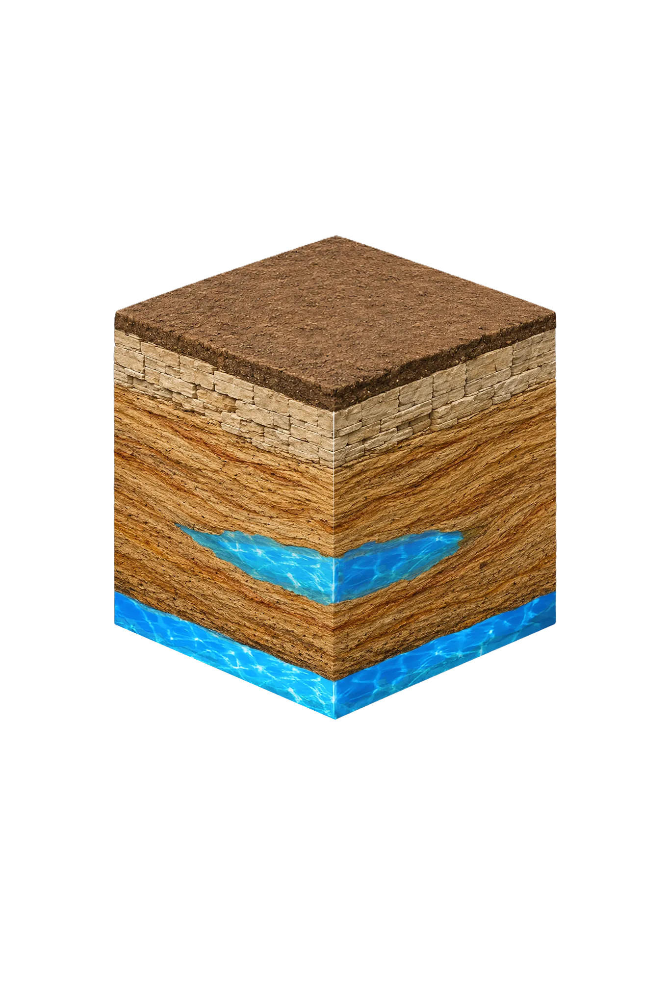

- Topsoil — Blackland margin / sandy loam transition0–15 ft
- Cretaceous limestone outcrop transition15–60 ft
- Woodbine Formation / Woodbine Aquiferoutcrop band; up to ~1,200 ft top downdip
Fannin County stratigraphy — top to bottom
- Topsoil — Blackland margin / sandy loam transition
- Dark reddish-brown clay loam. Beneath much of town lies the Bonham Marl, whose official reference site (its type locality) is near Bonham — a nice geological footnote, not a water source.
- Cretaceous limestone outcrop transition
- Thin pale limestone beds just above the band where the Woodbine reaches the surface.
- Woodbine Formation / Woodbine Aquifer
- The county's main water source. It reaches the surface in a band running roughly parallel to the Red River, then tilts downdip (deeper, away from the river) to about 1,200 ft near the eastern county line. Up to 600 ft thick — 700 ft near its downdip edge (TWDB Hydrologic Atlas 4). Its rust tint is a sign of iron. The river-deposited sandstone includes the Templeton, Lewisville, Red Branch, and Dexter members; the district's modeled available groundwater (MAG) is 4,934 acre-ft/yr.
0–15 ft
15–60 ft
outcrop band; up to ~1,200 ft top downdip
Fannin County stratigraphy — top to bottom
- Topsoil — Blackland margin / sandy loam transition (0–15 ft)
- Dark reddish-brown clay loam. Beneath much of town lies the Bonham Marl, whose official reference site (its type locality) is near Bonham — a nice geological footnote, not a water source.
- Cretaceous limestone outcrop transition (15–60 ft)
- Thin pale limestone beds just above the band where the Woodbine reaches the surface.
- Woodbine Formation / Woodbine Aquifer (outcrop band; up to ~1,200 ft top downdip)
- The county's main water source. It reaches the surface in a band running roughly parallel to the Red River, then tilts downdip (deeper, away from the river) to about 1,200 ft near the eastern county line. Up to 600 ft thick — 700 ft near its downdip edge (TWDB Hydrologic Atlas 4). Its rust tint is a sign of iron. The river-deposited sandstone includes the Templeton, Lewisville, Red Branch, and Dexter members; the district's modeled available groundwater (MAG) is 4,934 acre-ft/yr.
Drilling in Fannin County means starting in topsoil, working through Red River alluvium, Cretaceous limestone outcrop transition, to reach the Woodbine Formation / Woodbine Aquifer — the producing zone for most domestic wells.
The full layer-by-layer stratigraphy is laid out under the cube above. Well depth in Fannin County varies by property location and overburden thickness; we review TWDB records for neighboring wells to refine the expected completion zone before drilling.
Fannin County Quick Facts
- Primary Aquifer
- Woodbine
- Typical Well Depth
- Varies by location
- Groundwater District
- Red River GCD
- Confinement
- outcrop band roughly parallel to the Red River; dips eastward to ~1,200 ft top near the eastern Fannin County line
Secondary: Trinity (Antlers — deep, generally not residential)
We estimate from nearby well records
Water Quality Notes
- Iron and manganese in the Woodbine are documented problems, so treatment is commonly needed
- Water quality drops off quickly below about 1,500 ft, and the upper Woodbine carries excessive iron where it reaches the surface (the outcrop)
Cities We Serve in Fannin County
Bonham, TX
Licensed well drilling and pump service in Bonham and Fannin County, primarily targeting the Woodbine sandstone — depth varies sharply by location.
View Bonham details →Honey Grove, TX
Licensed well drilling and pump service in Honey Grove and eastern Fannin County, targeting the Woodbine sandstone — depth varies sharply by location.
View Honey Grove details →Ivanhoe, TX
Licensed well drilling and pump service in Ivanhoe and northern Fannin County, targeting the Woodbine near its outcrop band — depth varies by location.
View Ivanhoe details →Ravenna, TX
Licensed well drilling and pump service in Ravenna and northern Fannin County, targeting the Woodbine near the Red River outcrop band.
View Ravenna details →Telephone, TX
Licensed well drilling and pump service in Telephone and far northern Fannin County, targeting the Woodbine along the Red River outcrop band.
View Telephone details →Permits & Regulations in Fannin County
Fannin County wells are regulated by the Red River GCD. A pre-drilling permit is required before any new well is constructed. DFW Well Service submits the permit application as part of our drilling process.
Full Fannin County permit & regulations →Frequently Asked Questions about Fannin County Wells
What aquifer is under Fannin County?
How deep are wells typically drilled in Fannin County?
What water quality issues are common in Fannin County wells?
Does Fannin County require a permit to drill a water well?
What's the main producing formation in Fannin County?
Ready to drill or service a well in Fannin County?
Most calls answered same business day. Licensed TDLR driller.

Our Reliability Runs Deep
Licensed
TDLR License #61234 DKMPW
Oklahoma License DPC-1042 (Operator #OP-2530)
Request Well Service or a Drilling Estimate
Tell us a little about your property and what you need help with. We respond within a few hours during business hours.