
Need well service in Ivanhoe?

DFW Well Service helps property owners with water well drilling, pump service, inspections, and related well issues across North Texas.

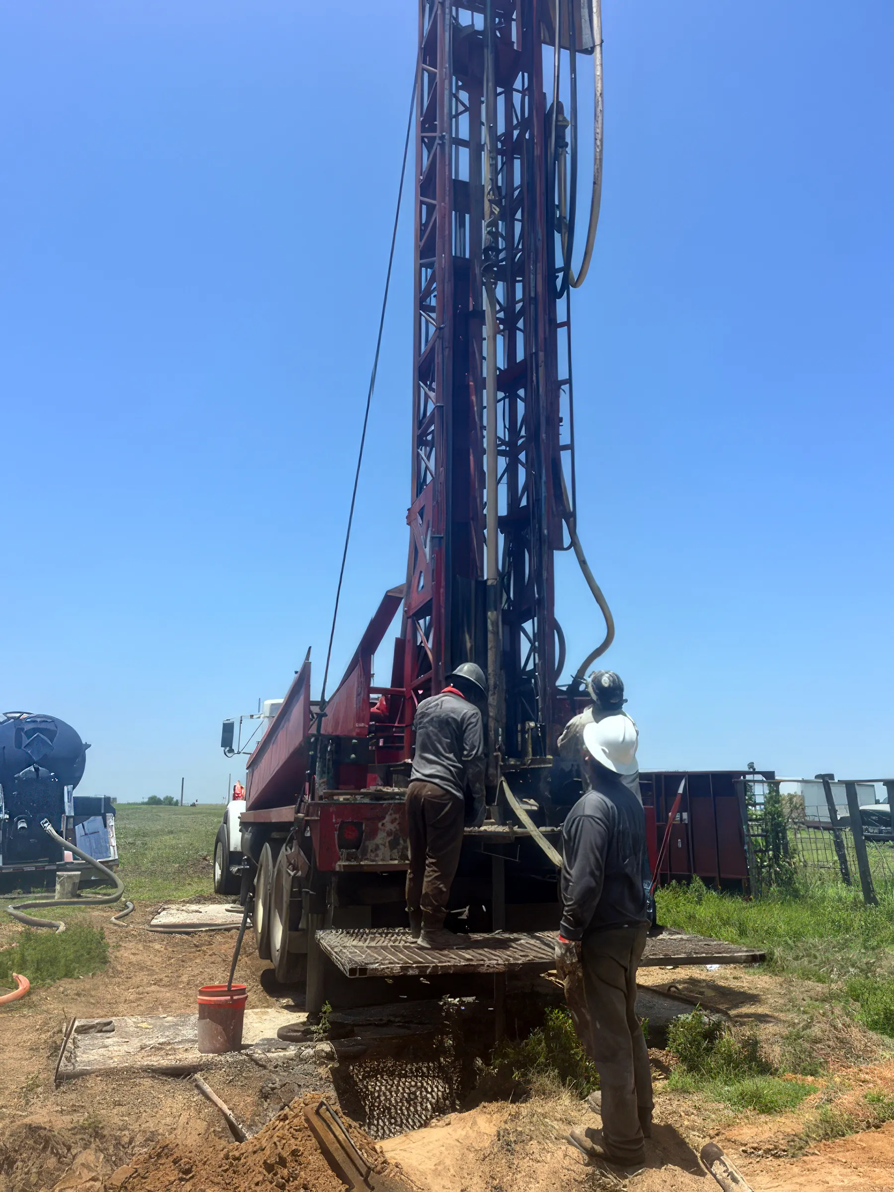
A DFW Well Service driller answering an incoming call on the job site, hands still dirty from the rig

We answer the phone.

When you call, you’ll get a real person — often Matt himself, not a machine. We stay in touch because it’s the right way to do business, and we show up when we say we will.

Call (940) 536-8560

Water Well Drilling & Pump Repair in Ivanhoe, TX | DFW Well Service

Service Area Overview

Licensed well drilling and pump service in Ivanhoe and northern Fannin County, targeting the Woodbine near its outcrop band — depth varies by location.

DFW Well Service is a trusted provider of water well and pump services in Ivanhoe and the rural communities of northern Fannin County that depend on private wells. Whether you need a new well drilled or an existing system repaired, we have the equipment and expertise to get the job done.

Services We Provide in Ivanhoe

Well Depth & Geology in the Ivanhoe Area
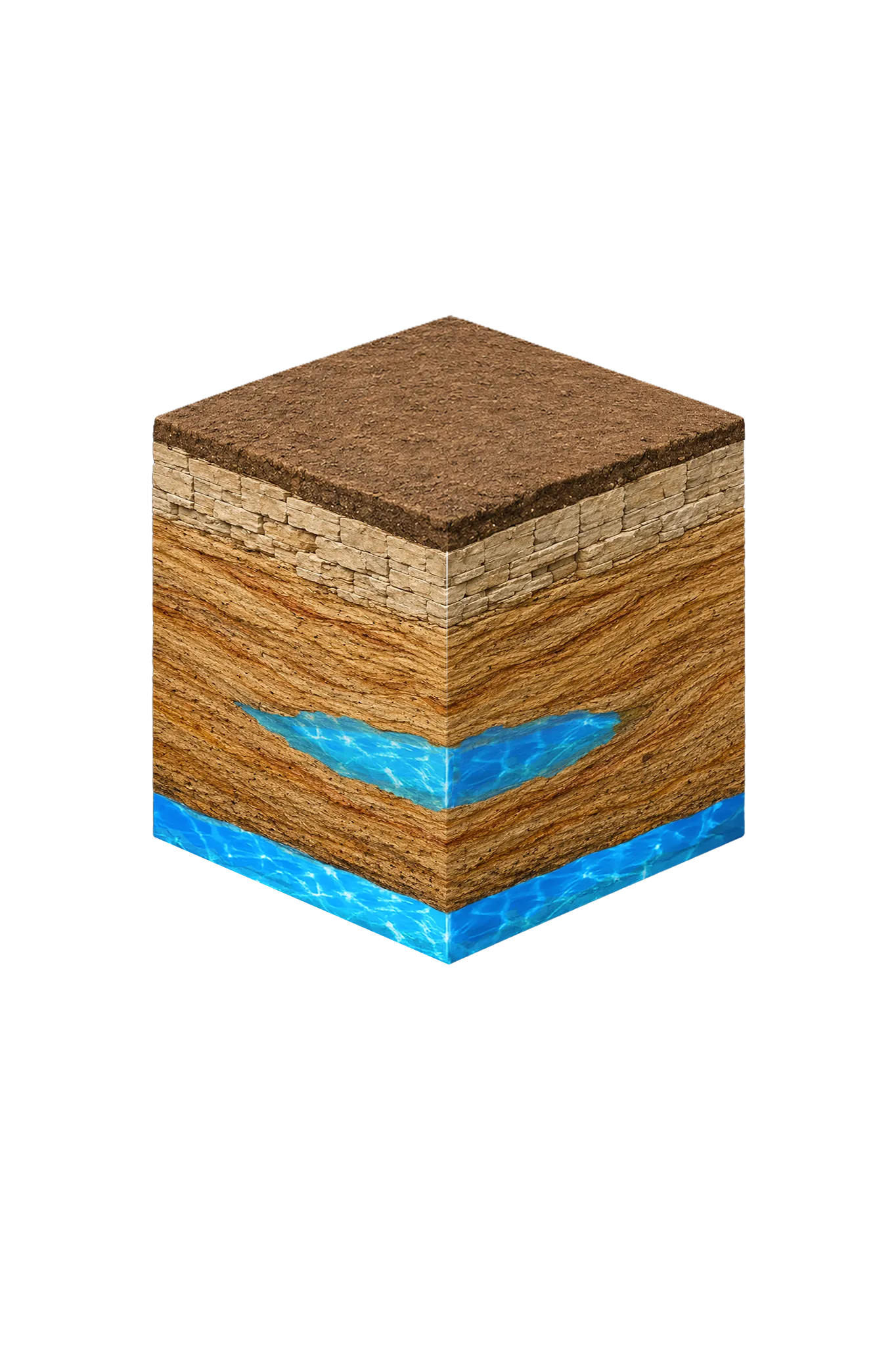
Isometric geological cross-section cube illustration showing Fannin County, Texas stratigraphy — Topsoil, Cretaceous limestone outcrop transition, Woodbine Formation / Woodbine Aquifer, Washita and Fredericksburg Groups, and the Woodbine aquifer at the base.

About this diagram

This cross-section shows the rock layers beneath Fannin County — the same stack under Ivanhoe — from topsoil down to the Woodbine aquifer system.

Tap any layer in the cube — or in the list below — to see what it is and what it means for drilling a well here.

  1. Topsoil — Blackland margin / sandy loam transition
    0–15 ft
  2. Cretaceous limestone outcrop transition
    15–60 ft
  3. Woodbine Formation / Woodbine Aquifer
    outcrop band; up to ~1,200 ft top downdip
Tap or hover a layer in the cube to see what's beneath the surface here.

This cross-section shows the layer stack typical of Fannin County. The exact formations and depths under a specific Ivanhoe-area property vary — see the details above.

Explore the full Fannin County geology →

Primary Aquifer
Woodbine

Secondary: Trinity (Antlers — deep, generally not residential)

Typical Well Depth
Varies by location

We estimate from nearby well records

Groundwater District
Red River GCD
Confinement
outcrop band roughly parallel to the Red River; dips eastward to ~1,200 ft top near the eastern Fannin County line

Fannin County overview → Permit & regulations → TDLR License #61234 DKMPW Updated August 7, 2026

Wells around Ivanhoe draw mainly from the Cretaceous Woodbine Formation, the principal residential aquifer across Fannin County. The Woodbine reaches the surface (outcrops) in a broad band running roughly parallel to the Red River and tilts down to the southeast, so the depth to productive water depends sharply on where your property sits relative to that band. Ivanhoe sits in the northern part of the county near that outcrop band, so wells here may reach productive Woodbine at moderate depth. The deeper Trinity Group — here the Antlers Formation — underlies the area but is generally too deep for a home well. The county’s sandy near-surface geology is easier (and cheaper) to drill than the limestone counties to the west.

Fannin County Permit Requirements

Well construction in Ivanhoe and throughout Fannin County is regulated by the Red River Groundwater Conservation District (RRGCD). A permit is required from the district before drilling begins, and construction must comply with TDLR standards for casing depth, grouting, and well completion. The RRGCD also requires a completion report following construction. See our guide to Fannin County water well regulations for the complete permit checklist.

Call DFW Well Service at (940) 536-8560 for a free estimate on your Ivanhoe-area well project. We serve all of Fannin County and neighboring areas with honest, professional well and pump services — TDLR License #61234 DKMPW.

Frequently Asked Questions

What formations supply well water in the Ivanhoe area?
Wells in Ivanhoe and northern Fannin County draw mainly from the Woodbine sandstone, the county's principal residential aquifer. The Woodbine reaches the surface (outcrops) in a broad band running roughly parallel to the Red River, and Ivanhoe sits near that band, so productive water can be within reach at moderate depth. The deeper Trinity Group — here the Antlers Formation — lies well below and is generally too deep for a home well.
How deep are water wells drilled near Ivanhoe?
There's no single typical depth across Fannin County — it varies sharply with where a property sits relative to the Woodbine outcrop band along the Red River. Properties near the outcrop band, as in the Ivanhoe area, may reach productive Woodbine at moderate depth, while farther east the Woodbine deepens toward the eastern county line. We review the driller's logs from neighboring wells before recommending a target depth.
What does well drilling cost in Fannin County?
Drilling rates near Ivanhoe typically run $28–$40 per foot — the sandy Woodbine formations here are less expensive to drill than the limestone counties to the west. Total cost depends on completion depth and the full system (casing, pump, pressure tank). We provide a free itemized written estimate after reviewing neighboring driller's logs for your parcel.
Is there a groundwater district in Ivanhoe?
Yes. Fannin County is within the Red River Groundwater Conservation District (RRGCD). All new wells require a permit from the RRGCD before drilling begins. DFW Well Service handles permit applications as part of every new well project.
Is water quality good in Ivanhoe-area wells?
Woodbine wells in Fannin County generally produce usable water, but iron and manganese are common concerns — the upper Woodbine zone has documented iron content, and outcrop areas can have excessive iron. Hardness, sulfate, and total dissolved solids that rise below about 1,500 ft of well depth are also worth testing for. We conduct water quality testing on all new wells and can recommend filtration or treatment based on results.
Is the well water in Ivanhoe salty or brackish?
Mostly fresh. The Woodbine around Ivanhoe is fresh along its outcrop band (where the sand reaches the surface), though it grows saltier below about 1,500 feet and toward the east, per Texas Water Development Board data. Iron is a more common issue than salt here — budget for an iron and total-dissolved-solids test (total dissolved solids being a measure of how mineral-heavy the water is).

Other cities we serve

Our crews cover Ivanhoe and communities across our 19-county North Texas service area.

Elsewhere in North Texas

See all of Fannin County
DFW Well Service

Our Reliability Runs Deep

Licensed

TDLR License #61234 DKMPW

Oklahoma License DPC-1042 (Operator #OP-2530)

Request Service

Tell us about the property and what you need help with.

Fields marked * are required.