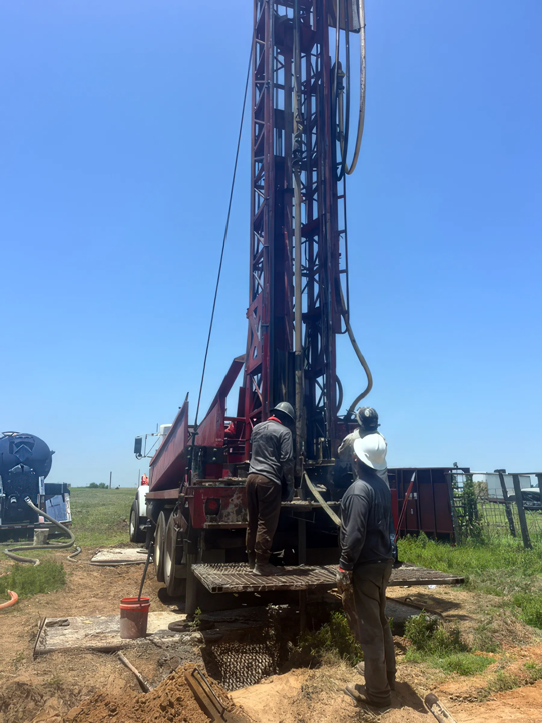

A DFW Well Service driller answering an incoming call on the job site, hands still dirty from the rig

We answer the phone.

When you call, you’ll get a real person — often Matt Muller himself, not a machine. We stay in touch because it’s the right way to do business, and we show up when we say we will.

Water Well Drilling & Pump Repair in Joshua, TX | DFW Well Service

Service Area Overview

Licensed well drilling and pump service in Joshua, TX, for Johnson County suburban and rural customers, reaching the Trinity aquifer.

DFW Well Service crew running a water well drilling rig near Joshua, TX

DFW Well Service provides professional water well and pump services throughout Joshua and Johnson County. Whether you’re on a growing suburban property, a rural acreage lot, or a small farm south of Fort Worth, our licensed team delivers reliable well solutions at fair prices.

Well Depth & Geology in the Joshua Area
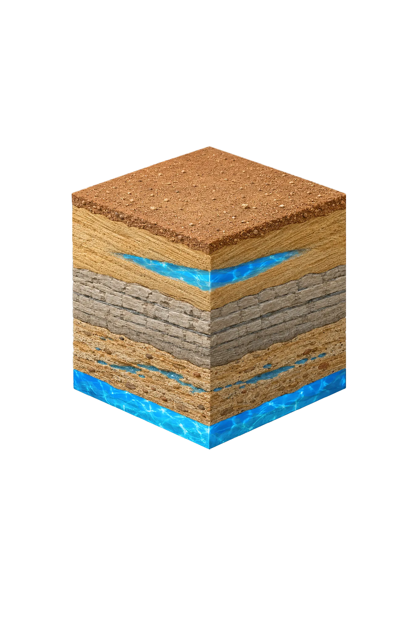
Isometric geological cross-section cube illustration showing Johnson County, Texas stratigraphy — Topsoil, Austin Chalk (eastern Johnson County confining unit), Eagle Ford Shale (eastern Johnson County confining unit), Washita Group (Main Street, Weno, Denton limestones and shales), Fredericksburg Group (Edwards Limestone, Comanche Peak, Walnut Clay), Paluxy Sand (Trinity upper unit), Glen Rose Formation, Hosston Conglomerate (Trinity basal sand; = Twin Mountains), and the Trinity (Paluxy / Glen Rose / Hensell / Hosston) aquifer at the base.

About this diagram

This cross-section shows the rock layers beneath Joshua from topsoil down to the Trinity aquifer system.

Tap any layer in the cube — or in the list below — to see what it is and what it means for drilling a well here.

  1. Topsoil — Blackland Prairie / Cross Timbers fringe
    0–15 ft
  2. Paluxy Sand (Trinity upper unit)
    outcrop west; deep east
  3. Glen Rose Formation
    below Paluxy
  4. Hosston Conglomerate (Trinity basal sand; = Twin Mountains)
    deepest Trinity
Tap or hover a layer in the cube to see what's beneath the surface here.

This shows the layer stack typical of the Joshua area. The exact formations and depths under a specific property vary — see the details above.

Explore the full Johnson County geology →

Primary Aquifer
Trinity (Paluxy / Glen Rose / Hensell / Hosston)

Secondary: Woodbine (subsurface across central and eastern Johnson County)

Typical Well Depth
Varies by location

We estimate from nearby well records

Groundwater District
Prairielands GCD
Confinement
outcrop/shallow subcrop in western Johnson County; deep confined beneath Eagle Ford/Austin Chalk in eastern Johnson County

Johnson County overview → Permit & regulations → TDLR License #61234 DKMPW Updated June 4, 2026

Wells around Joshua draw mainly from the Trinity aquifer, and Joshua’s spot in northern/north-central Johnson County tends to put it where the Trinity runs nearer the surface than in eastern Johnson. Near the surface here, you’ll often hit the Washita Group (limestone and shale) first. Below that, the Trinity’s upper Paluxy sand and deeper basal sands (the Twin Mountains, which Prairielands GCD calls the Hensell and Hosston) are the primary water source, with the Woodbine a minor source in parts of the county. Between the Paluxy and the basal sands sits the Glen Rose Formation — mostly limestone that holds little water and seals the sand below.

Johnson County Permit Requirements

Well construction in Joshua is regulated by the Prairielands Groundwater Conservation District (PGCD). A well permit is required before any drilling begins, and all construction must meet TDLR standards. The PGCD enforces spacing and setback rules and requires a completion report with driller’s log after the well is finished. For a complete overview, see our guide to Johnson County water well regulations.

DFW Well Service is ready to help with your Joshua or Johnson County well project. Call (940) 536-8560 for a free estimate — we serve Joshua, Burleson, Cleburne, Alvarado, and all of Johnson County with licensed, professional well and pump services.

Frequently Asked Questions

What formations supply well water in Joshua, TX?
Wells in Joshua draw mainly from the Trinity aquifer — the upper Paluxy sand and the deeper basal sands (the Twin Mountains, which Prairielands GCD calls the Hensell and Hosston) — plus the Woodbine in places as a minor source. Between the Paluxy and those basal sands sits the Glen Rose Formation, mostly limestone that holds little water and seals the sand below rather than producing from it.
How deep are wells near Joshua?
There's no single typical depth across Johnson County — it varies meaningfully from one parcel to the next, so we review the driller's logs from neighboring wells before recommending a target depth. Joshua sits in the northern/north-central part of the county, where the Trinity runs nearer the surface than in eastern Johnson, so wells here can reach it without as much overlying cover.
What does a new well cost near Joshua?
Drilling rates in Johnson County run approximately $32–$50 per foot. Final cost depends on completion depth and the full system (casing, pump, pressure tank). We provide a free itemized written estimate after reviewing neighboring driller's logs for your parcel.
What groundwater district covers Joshua?
Joshua is within the Prairielands Groundwater Conservation District (PGCD), which manages groundwater resources for Johnson County and several neighboring counties. All new wells require a permit from the PGCD before drilling begins. DFW Well Service handles the permit application process as part of your project.
Is Joshua growing fast enough to affect well water availability?
Johnson County has seen significant population growth in recent years, particularly in communities like Joshua. While the Trinity aquifer is generally robust, increased demand can affect static water levels in some areas over time. This makes proper well construction and casing depth especially important — we follow PGCD guidance on sustainable completion depths.
Can you service a pump on an existing well in Joshua?
Absolutely. Pump repair and replacement is one of our core services throughout Johnson County. If your well has lost pressure, the pump is cycling rapidly, or you're getting no water at all, call (940) 536-8560. We carry common pump sizes and parts on our service trucks and can often resolve issues in a single visit.
Is the well water in Joshua salty or brackish?
Mostly fresh. Western Johnson County around Joshua draws fresh Trinity at or near the surface. The Texas Water Development Board flags localized salty pockets in the Woodbine outcrop (from natural sulfate) and notes the deep lower Trinity under Johnson County is largely non-fresh, so deeper or eastern wells warrant a full test for total dissolved solids — a measure of how mineral-heavy the water is — and sulfate.

Other cities we serve

Our crews cover Joshua and communities across our 19-county North Texas service area.

Elsewhere in North Texas

See all of Johnson County
DFW Well Service

Our Reliability Runs Deep

Licensed

TDLR License #61234 DKMPW

Oklahoma License DPC-1042 (Operator #OP-2530)

Request Service

Tell us about the property and what you need help with.

Fields marked * are required.