

Water Well Drilling & Pump Repair in Stephenville, TX | DFW Well Service
Service Area Overview
Licensed well drilling and pump service in Stephenville, TX, reaching the Trinity aquifer's Paluxy and Twin Mountains sands; depth varies by parcel.

Services We Provide in Stephenville
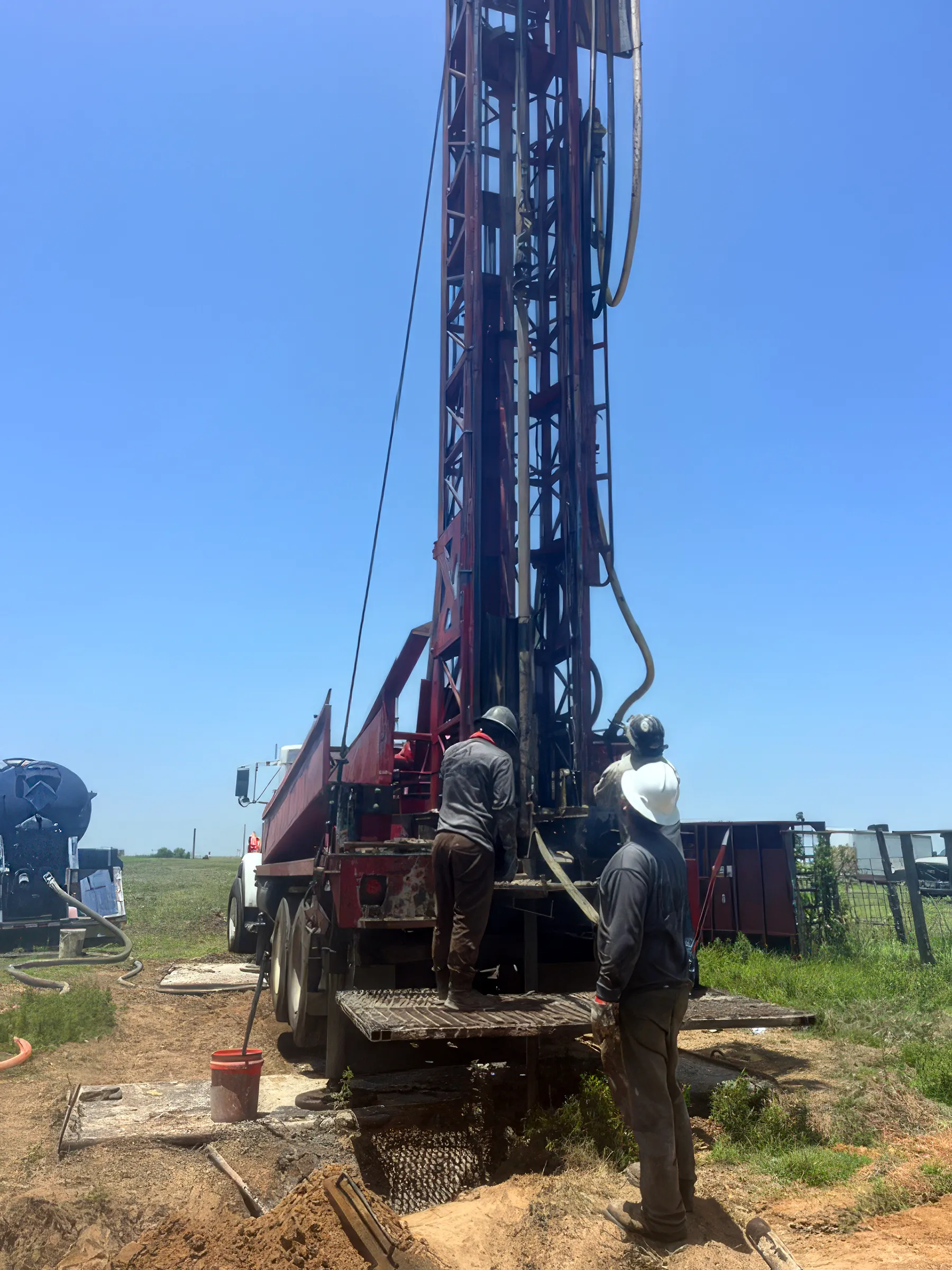
DFW Well Service (TDLR License #61234 DKMPW) is a licensed well contractor serving Stephenville and Erath County with residential, ranch, and agricultural water well services.
Wells here reach the Trinity aquifer’s sand layers — the Paluxy nearer the surface and the deeper Twin Mountains basal sand — with depth varying by parcel; the strongest local anchor is a 332-foot monitor well just south of town on US Highway 281, which has shown only about 11 feet of water-level decline since 2000. Stephenville is itself the headquarters of the Middle Trinity Groundwater Conservation District, the authority that permits every new well here, and we handle that permitting as part of the job.
Well Depth & Geology in the Stephenville Area
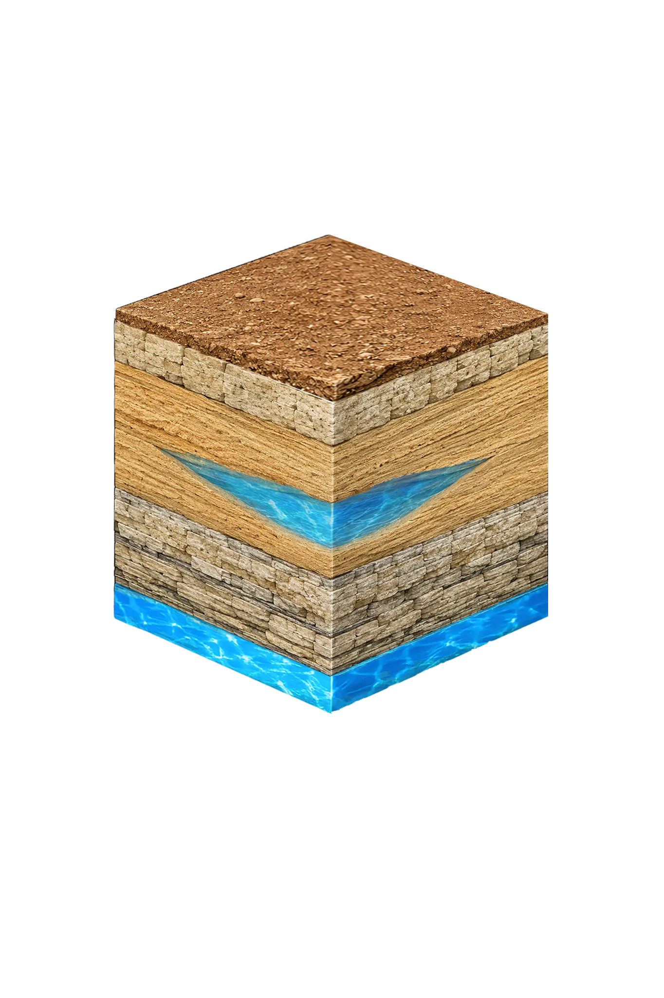

About this diagram
This cross-section shows the rock layers beneath Stephenville from topsoil down to the Trinity aquifer system.
Tap any layer in the cube — or in the list below — to see what it is and what it means for drilling a well here.
- Topsoil — Post Oak / Cross Timbers0–20 ft
- Comanche Peak / Walnut limestone cap20–60 ft
- Paluxy (Upper Trinity sand)shallow to moderate where present
- Glen Rose (Middle Trinity)varies
This shows the layer stack typical of the Stephenville area. The exact formations and depths under a specific property vary — see the details above.
- Primary Aquifer
- Trinity
- Typical Well Depth
- Varies by location
- Groundwater District
- Middle Trinity GCD
- Confinement
- outcrop / near-outcrop transition county
Secondary: Brazos River Alluvium (TWDB minor aquifer)
We estimate from nearby well records
Erath County overview → Permit & regulations → TDLR License #61234 DKMPW Updated June 4, 2026
Wells around Stephenville draw from the Trinity aquifer, and the city is also the headquarters of the Middle Trinity Groundwater Conservation District. The Trinity’s main sand layers here are the Paluxy nearer the surface and the deeper Twin Mountains basal sand; local and district planning materials also break the Trinity into several other named units (Glen Rose, Travis Peak, Hensell, Pearsall, Hosston, and — where the Glen Rose thins south of town — the Antlers), but for a homeowner it’s all one Trinity system. The strongest local depth anchor is the TWDB/MTGCD monitor well south of Stephenville on US Highway 281 (well #3155504): 332 feet deep, completed in the Twin Mountains sand, and tracked continuously since February 2000, with only about 11 feet of water-level decline over 26 years.
Erath County’s agricultural economy — particularly its dairy operations — creates demand for high-yield wells capable of sustaining large water draws. Standard residential wells are also common in the county, and Stephenville’s growing population includes both city residents and rural homeowners on private well systems.
Erath County Permit Requirements
All water wells in Stephenville and Erath County must be permitted through the Middle Trinity Groundwater Conservation District and TDLR. The Middle Trinity GCD requires a permit before drilling and a well completion report afterward. Agricultural wells may have additional yield-reporting requirements.
For more detail, see our guide to Erath County water well regulations.
Call DFW Well Service at (940) 536-8560 for a free estimate on any well project in the Stephenville area. We serve all of Erath County and are experienced with both the Middle Trinity GCD permit process and the area’s formation characteristics.