

Water Well Drilling & Pump Repair in Waxahachie, TX | DFW Well Service
Service Area Overview
Licensed well drilling and pump service in Waxahachie, TX. Woodbine is the primary Ellis County residential aquifer; Trinity is deep here.

Services We Provide in Waxahachie
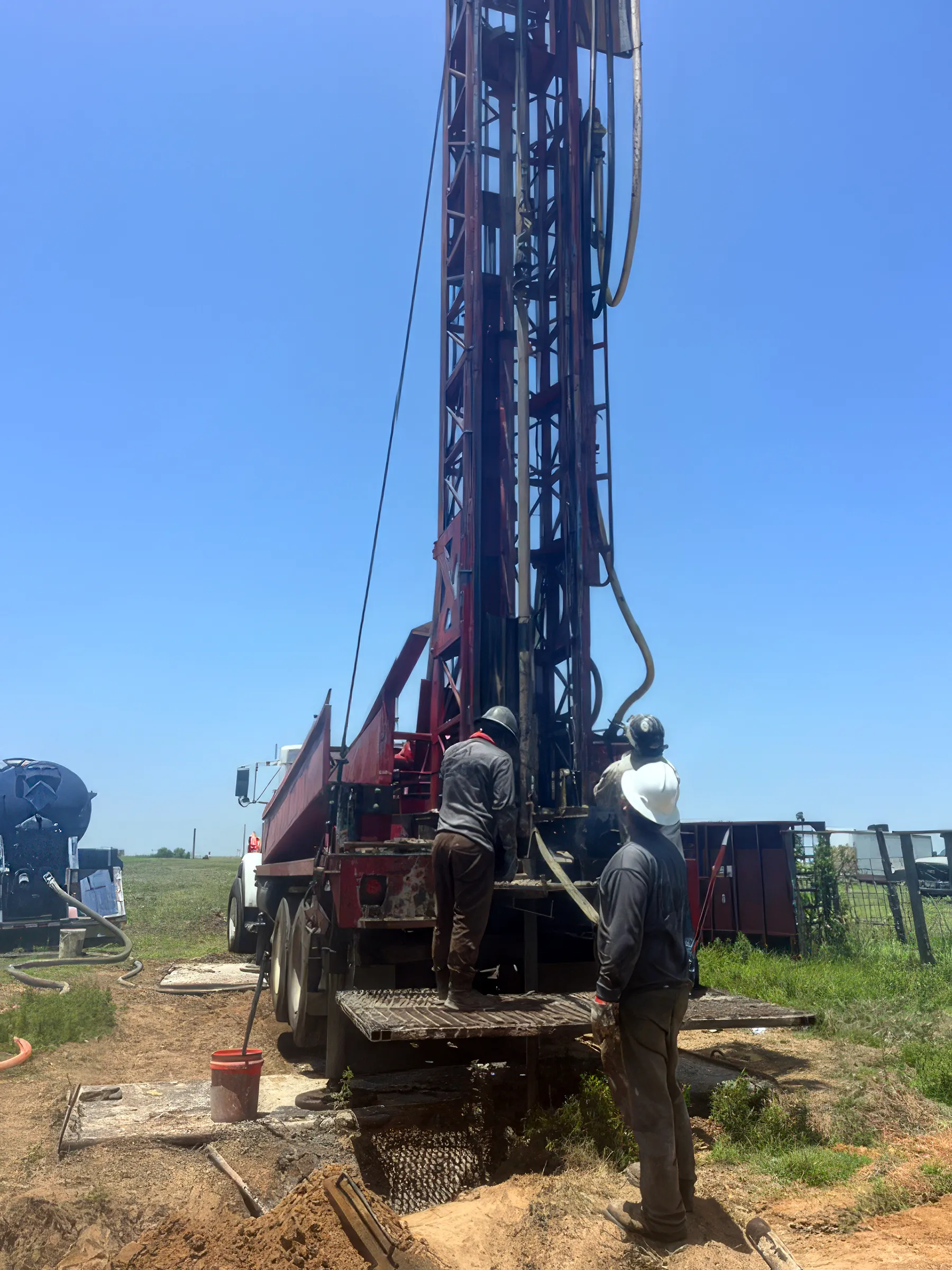
DFW Well Service (TDLR License #61234 DKMPW) provides water well drilling and complete well services for residential and rural customers in Waxahachie and throughout Ellis County.
Waxahachie sits on Austin Chalk bedrock in central Ellis County, where the Woodbine is the primary residential aquifer and the deeper Trinity sands — the Twin Mountains and Paluxy — lie roughly 2,000 to 3,000 feet down. New wells are permitted through the Prairielands Groundwater Conservation District, and because many in-town properties are on municipal water, private wells are more common on rural acreage outside the city.
Well Depth & Geology in the Waxahachie Area
About this diagram
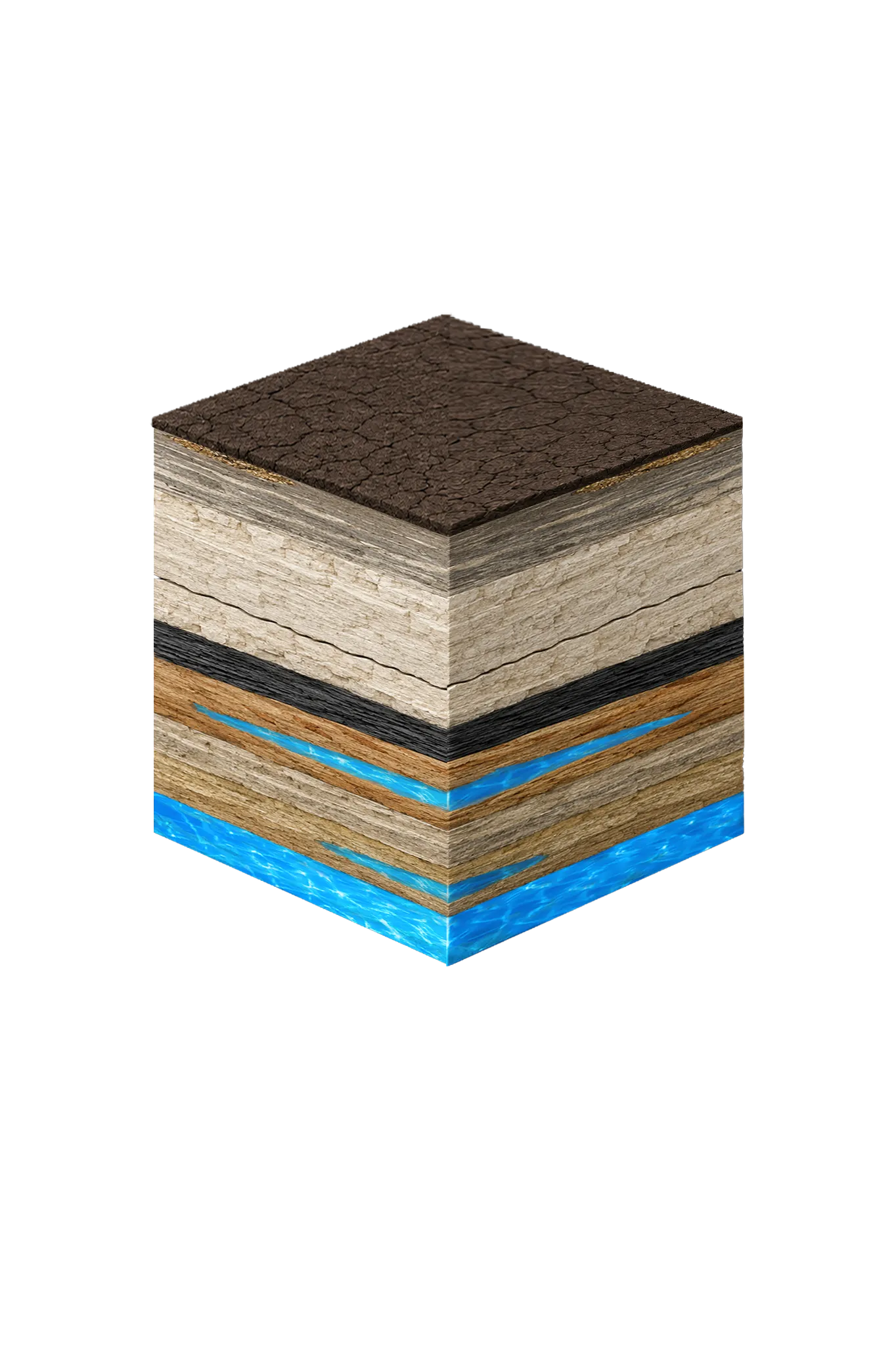
This cross-section shows the rock layers beneath Waxahachie from topsoil down to the Woodbine aquifer system.
Tap any layer in the cube — or in the list below — to see what it is and what it means for drilling a well here.
- Topsoil — Blackland Prairie (Houston Black)0–15 ft
- Austin Chalkvaries
- Eagle Ford Shalebelow Austin Chalk
- Woodbine Formation / Woodbine Aquifer100–1,400 (variable across county) ft
- Trinity Group: Paluxy / Glen Rose / Hensell / Hosston (= Twin Mountains)~2,000–3,000 (Hosston/Twin Mountains) ft
This shows the layer stack typical of the Waxahachie area. The exact formations and depths under a specific property vary — see the details above.
- Primary Aquifer
- Woodbine
- Typical Well Depth
- Varies by location
- Groundwater District
- Prairielands GCD
- Confinement
- deep confined subcrop; ~100–1,400 ft beneath Ellis County
Secondary: Trinity (deep — Hosston/Twin Mountains at ~2,000–3,000 ft)
We estimate from nearby well records
Ellis County overview → Permit & regulations → TDLR License #61234 DKMPW Updated June 4, 2026
Wells around Waxahachie draw mainly from the Woodbine, the primary residential aquifer across Ellis County, with the deeper Trinity as a secondary target below it. Waxahachie sits on Austin Chalk bedrock in central Ellis County; the Woodbine has a regional thickness of roughly 100–1,400 feet, and the deeper Trinity sands (the Twin Mountains and Paluxy) reach roughly 2,000–3,000 feet down here. Many Waxahachie properties are on municipal water, so private wells are more common on rural acreage outside the city.
Waxahachie’s position as Ellis County seat and a growing suburban center means well service needs range from historic rural homesteads with decades-old equipment to newly drilled wells on acreage lots at the edges of city growth. We serve the full spectrum.
Ellis County Permit Requirements
Water wells in Waxahachie and Ellis County are regulated by TDLR and the Prairielands Groundwater Conservation District. The Prairielands GCD requires a permit application before drilling begins and a well completion report after the work is done, and its spacing rules set minimum distances from property lines and neighboring wells. TDLR construction standards govern separation from septic systems and other contamination sources.
For more information on local regulations, see our guide to Ellis County water well regulations.
Call DFW Well Service at (940) 536-8560 for a free estimate on well drilling, pump repair, water testing, or any well service in the Waxahachie area. We’ll come out, assess your situation, and give you straightforward pricing with no obligation.